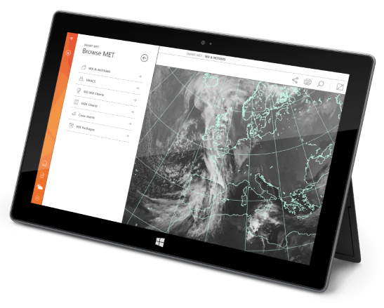
Smart MET (part of Smart BRIEF) – provides an easy, customizable way of grouping several weather products into weather packages, to provide users tailored area weather briefings. It also allows to display different kinds of weather-related information for selected airports on your mobile device.
S4A Smart MET interactive maps allow crews to overlay their flight route with various aviation weather graphical layers, providing the highest level of detail on expected en-route conditions.
With the help of S4A Smart MET maps, you can see not only your flight position, stations and weather but also full ETOPS information, the most up-to-date weather data (including UAD and SigWX charts) generated by Met Office-certified, built-in map generator, and icing charts.
You can dynamically enable/disable layers and can change the flight level displayed on your charts.
Key Features:
- Station surface weather and forecasts
- SIGMET
- SigWX SWH / SWM charts
- Radar imagery
- Satellite imagery
- UAD charts
- Icing conditions charts
- Information on storm systems
- Volcanic Ash monitoring
- PIREP monitoring