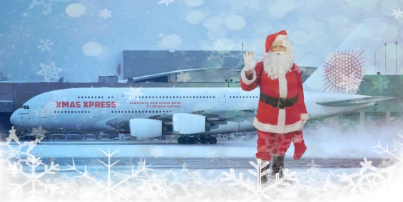
Where does Santa’s sleigh actually fly?
19 Dec 2017
{{vendor.Name}}
Connect with Aircraft IT
Click here to learn about free Membership to Aircraft IT
Where does Santa’s sleigh actually fly?
Lufthansa Systems delivers relevant flight data for calculating Santa Claus’ optimum route around the world
Raunheim, December 19, 2017 – To make sure the man with the white beard and red suit can deliver all his gifts on time again this year, a team of experts from Lufthansa Systems worked with representatives from the MATHEON Research Center and Konrad Zuse Institute Berlin to calculate the shortest round trip around the globe. The project was launched by the German “Wissenschaft im Dialog” research initiative at the end of 2016.
The team discovered that Santa Claus needs approximately 406 hours, or almost 17 days, to reach every single child in the world. In doing so, he would travel 365,174 kilometers, equivalent to more than nine times the circumference of the Earth. The optimal flight route takes him from the North Pole via Europe and the Middle East to Russia, and then on to Asia and back to Africa. After that, the sleigh travels on to North and South America, stopping off in Hawaii before heading for Papua New Guinea and Australia. Santa’s return journey includes one or two more stops in Asia, on the Arabian peninsula and in Europe before he can final enjoy a well-deserved rest back at the North Pole. As the route leads from west to east across the International Date Line, he even loses a day along the way. Nevertheless, Santa’s ability to stop time led the team to conclude that this will be no problem and that all children will once again wake up to a Christmas surprise or two again this year.
Flight planning solutions always calculate the shortest flight connection between two waypoints, while taking into account factors such as flight time, aircraft type, fuel consumption and weather. The calculation for this project was based on the following simplified assumptions: The route begins at the North Pole and includes 1,305 destinations around the world. To save time, Santa Claus does not land en route. Instead, he throws presents from his sleigh and lets his regional elves distribute them. He flies at a constant speed (900 km/h) and altitude (10 km). His ground speed (speed relative to the surface of the Earth) takes the wind into account. It increases with a tailwind and decreases with a headwind, and Santa also compensates for crosswinds. Santa has to stop time to complete the long journey, which means weather conditions also remain constant – the assumption uses the conditions at 23:00 UTC on Christmas Day 2015. As he carries a bottomless sack of presents, the weight of gifts for two billion children is not included in the calculation. Similarly, overflight fees are not taken into account in this case. Under these conditions, a connection with minimal fuel consumption (or reindeer food) also has the shortest flight time.
Crossovers, loops and apparent detours on the route are not mistakes. A longer flight route can be faster and save more fuel than what appears to be the best direct connection in a large arc. In addition, Santa Claus’ status as a role model for children everywhere means he must remain on the network of airways. This global network has around 300,000 routes at each of approximately 30 permitted altitudes.
Aviation IT specialist Lufthansa Systems contributed the relevant airways network data for this project together with additional weather and aircraft performance information. Flight planning experts are thoroughly familiar with these criteria, as around 120 airlines with a total of more than 6,000 aircraft worldwide use Lufthansa Systems’ Lido/Flight 4D flight planning solution, which has been successful in the market for just over 20 years and has a market share of 45 percent in Europe alone. If Santa Claus adds connectivity to his sleigh in future, it will even be possible to incorporate live weather data from Lido/Navigation into the calculation.
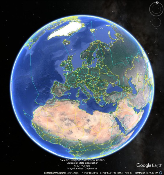
Anyone wanting to follow Santa’s route can download the appropriate KML file at www.wissenschaft-im-dialog.de. Direct link: https://tinyurl.com/yatfma89
Google Earth must be installed in order to view the file.
Images (Copyright: Google Earth): Excerpts of Santa’s optimal route, according to calculations from Lufthansa Systems, MATHEON and the Konrad Zuse Institute.
For more information about the project partners, visit: www.zib.de and www.matheon.de